How Much Does Drone Real Estate Photography Cost in Charleston?
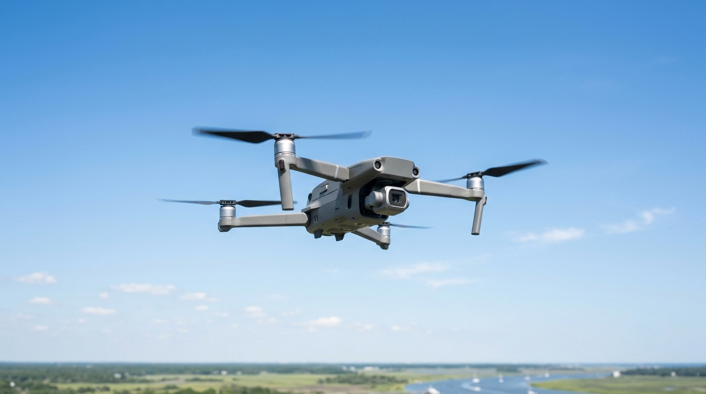
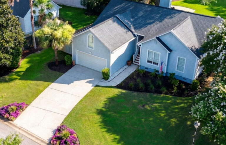
Drone and aerial photography has become a standard part of how listing agents in Charleston market properties across every price tier. It is not reserved for waterfront estates or luxury listings. Agents add drone coverage to show a backyard pool setup, a cul-de-sac lot, a neighborhood entrance, proximity to major roads or amenities, roof condition from above, and exterior angles that a tripod at ground level simply cannot reach. For any listing where the lot, the location, or the exterior is part of what you are selling, aerial coverage does a job that nothing else in the media package can replicate.
As the service has become more common, pricing has settled into fairly predictable ranges across the Charleston market. What you pay depends mostly on how you book: whether you add aerial coverage to an existing photo shoot, book a standalone drone session, or combine drone into a larger listing media package.
This guide covers what drone real estate photography costs in the Charleston market, what drives pricing differences, and how to evaluate what you are getting for the price. For a broader look at when and why aerial coverage matters for a Charleston listing in the first place, see our complete guide to drone and aerial real estate photography in Charleston.
What Drives Drone Photography Pricing
Before looking at numbers, it helps to understand what goes into the cost of a professional drone shoot. Several factors affect what a licensed operator charges.
FAA Part 107 certification and insurance. The FAA classifies any drone flight conducted to market a property for sale as commercial operation, regardless of whether the photographer is separately paid for the drone work. That means every legitimate real estate drone shoot requires a pilot operating under FAA Part 107 commercial license. Obtaining and maintaining that license requires passing an aeronautical knowledge exam, TSA vetting, and recurrent training every 24 months. Commercial liability insurance adds to the operating cost as well. Operators who carry proper certification and insurance charge accordingly. Operators who do not are cutting corners that expose your listing to real risk. For a full breakdown of what licensing means for agents hiring a drone photographer, see our guide to FAA licensed drone photographers for real estate in Charleston.
Pre-shoot airspace planning and day-of checks. The Charleston area includes multiple airspace considerations that require attention before and on the day of every shoot. Charleston International Airport creates Class C controlled airspace across a significant portion of the metro area, with different authorized altitude ceilings depending on how close a property sits to the airport. North Charleston, Park Circle, and portions of West Ashley all fall within or near this airspace, each with different altitude grids that a licensed operator checks before every shoot. Joint Base Charleston adds a separate restricted airspace zone to the north. Charleston Executive Airport on Johns Island introduces additional controlled airspace in that part of the market as well.
Beyond standing airspace, conditions can change between booking and shoot day. Temporary Flight Restrictions can be issued with little notice for emergency operations, military exercises, or other events. Active TFRs are checked on the day of the shoot, not just at the time of booking. Cloud clearance requirements under Part 107, which require flying at least 500 feet below cloud bases and 2,000 feet horizontally from clouds, are also assessed day-of since weather conditions in the Lowcountry can shift between morning and shoot time. A professional operator builds all of this into standard pre-flight procedure. That time and planning is part of what the price reflects.
Image count and shoot scope. Pricing typically reflects how many edited aerial images are delivered. A basic add-on covering a handful of exterior aerials costs less than a standalone session built around a property where aerial coverage is the centerpiece of the listing package.
Travel and location. Properties on the barrier islands, in outlying areas, or in locations that require additional access planning may carry a travel surcharge depending on the operator.
Drone Photography Pricing in the Charleston Market
Across the Charleston market, drone and aerial photography pricing for residential real estate generally falls into two booking formats.
Add-on to an existing photo shoot. The most common booking format. Most real estate photographers offer drone as an add-on to their standard listing photo service, meaning the drone coverage is booked and shot alongside the interior and exterior photos in a single visit. Because the photographer is already on-site, the add-on rate reflects only the additional aerial work rather than a full separate mobilization. In the Charleston market, drone add-on pricing typically runs in the range of $95 to $150 on top of whatever the base photo service costs, depending on the operator and image count.
At Real Estate Photography for Charleston, the Standard Shoot is $189 for up to 25 interior and exterior photos, and the Large Shoot is $239 for up to 40 photos. Adding drone to either is $100 on top of those base rates, bringing the Drone + Standard Shoot to $289 and the Drone + Large Shoot to $339. Both deliver up to 8 edited aerial images alongside your listing photos in a single next-day package.
Standalone drone session. A standalone session means drone only, with no interior or exterior listing photos combined. It is not a reduced-scope service. A standalone shoot still requires the same travel, pre-flight airspace checks, equipment setup, flight time, and post-processing as any professional drone engagement. The difference is simply that the deliverable is aerial images alone. This format makes sense for lots, land, waterfront properties, or any listing where aerial coverage is the priority and interior photos are not needed. In the Charleston market, expect a standalone drone session from a properly licensed, insured operator to run in the $150 to $200 range. The Standalone Drone Session at Real Estate Photography for Charleston is $199, delivering up to 12 edited aerial images with next-day delivery.
How to Think About Drone Photography Cost Against Listing Value
The most useful frame for evaluating drone photography pricing is not the absolute dollar amount but the cost relative to what the aerial coverage communicates for that specific listing.
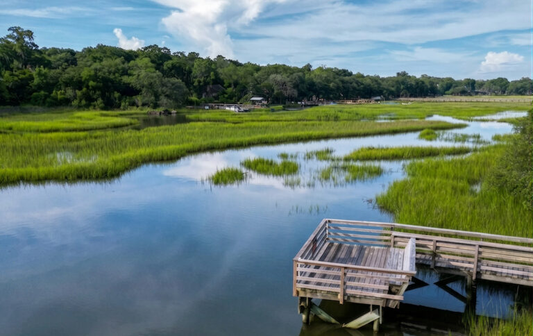
On a waterfront property in Mount Pleasant listed at $900,000, adding $289 in aerial coverage to a photo shoot represents a fraction of a percent of the list price. The aerial images show the dock, the water access, and the rear of the property in a way that no ground shot can match.
On a new construction home in Summerville near Nexton, a drone shot showing the neighborhood entrance, the proximity to the amenity center, and the surrounding community layout gives out-of-market buyers context that interior photos never provide.
On a standard residential listing where the backyard has a pool, a screened porch, and a well-landscaped lot, aerial coverage at the add-on price point shows that outdoor living setup in a single frame that no tripod-height exterior shot reaches.
The question is not whether drone photography is expensive. At the price points available in the Charleston market, it is not. The question is whether the listing has features that aerial coverage communicates better than anything else in the package. For a wide range of Charleston listings across every price tier, the answer is yes.
What You Should Expect at Different Price Points
Understanding what separates pricing tiers helps agents evaluate quotes across providers.
Budget end of the market (under $100 add-on or standalone). Entry-level pricing at this range is worth scrutinizing. Ask for the Part 107 certificate number and proof of commercial liability insurance. An operator who cannot produce both is not operating legally under FAA commercial rules. Budget pricing that reflects no certification and no insurance creates exposure for your listing that is not worth the savings.
Mid-range ($125 to $200). This is where most professionally operated, FAA-certified residential drone work sits in the Charleston market. Expect a clean aerial stills package, reliable next-day turnaround, and an operator who handles airspace authorization and day-of TFR and weather checks as standard practice.
Bundled packages ($249 and above). Combining interior photography with aerial coverage in a single package is increasingly the standard booking format for agents who add drone regularly. The advantage is a single booking, a single delivery window, and a cohesive set of listing images that covers both interior and exterior aerial coverage. For most Charleston listings that warrant drone photography, a bundled package is the most efficient way to book.
Pricing Transparency and What to Watch For
A few things worth confirming when evaluating drone photography pricing in this market.
Certification. Every legitimate commercial real estate drone shoot requires an FAA Part 107 certified pilot. Ask any provider you work with to confirm their certification status. You can verify a pilot’s certificate directly through the FAA airman registry if you want to confirm it independently.
Insurance. Unlicensed operators cannot obtain commercial drone insurance. Standard commercial drone liability coverage runs $1M per occurrence. Some brokerages require a Certificate of Insurance before allowing drone work on a listing. A properly insured operator can produce a COI on request.
Image count and delivery timeline. Confirm how many edited aerial images are included in the price and when delivery is expected. Next-day delivery is standard at Real Estate Photography for Charleston. Some operators deliver in 48 to 72 hours, which affects your listing timeline.
Travel surcharges. If your listing is on a barrier island or in an outlying area, ask upfront whether a travel fee applies. Some providers charge surcharges for Isle of Palms, Sullivan’s Island, Folly Beach, Kiawah, and other island or peninsula locations.
Current Drone Photography Pricing at Real Estate Photography for Charleston
All drone and aerial photography services include FAA Part 107 certification, full commercial liability insurance, and next-day delivery as standard.
Drone + Standard Shoot: $289. Up to 25 interior and exterior photos plus up to 8 edited aerial images. Single booking, single next-day delivery.
Drone + Large Shoot: $339. Up to 40 interior and exterior photos plus up to 8 edited aerial images. Single booking, single next-day delivery.
Essential Listing Package. Includes photos, drone, Zillow 3D Home tour, and auto-generated floor plan. Everything a listing needs in a single booking.
The Complete Listing Package. Includes everything in the Essential package plus video, virtual twilight, and 48-hour turnaround. The full media package for listings that need it.
Standalone Drone Session: $199. Up to 12 edited aerial images. For lots, land, waterfront, or any listing where aerial is the priority. Next-day delivery.
Drone Add-On: $125. Add aerial coverage to any service outside a Standard or Large Shoot. Up to 8 edited aerial images. Same delivery window as your primary service.
To book or add drone coverage to an upcoming listing, visit the drone photography service page or call 843-790-2820.